Labels

Cooking (53) Outdoors (32) Travels (44) Updates (36)

Saturday, October 20, 2012

Yurting

J, Kels, Josh and I all went up last weekend to State Forest State Park for my first yurt experience (Josh's too!). We stayed at the Clark Peak Yurt and were happy to be enjoying a crisp, autumn experience in the mountains. 
Mother Nature had other plans for us.
As J and I settled in to the yurt to enjoy the warmth of the fire and await the arrival of K and J, it began to snow, and then lightening, and then thunder. K and J made it safely to the yurt that night, but it was still snowing. As it was the next morning. A foot of snow or so later our autumnal getaway had turned into a surprise winter wonderland. Lesson: always pack snow pants!


The view from the deck of the yurt.

That bright light between the trees and the sky is the snow on the mountain reflecting the sunset.

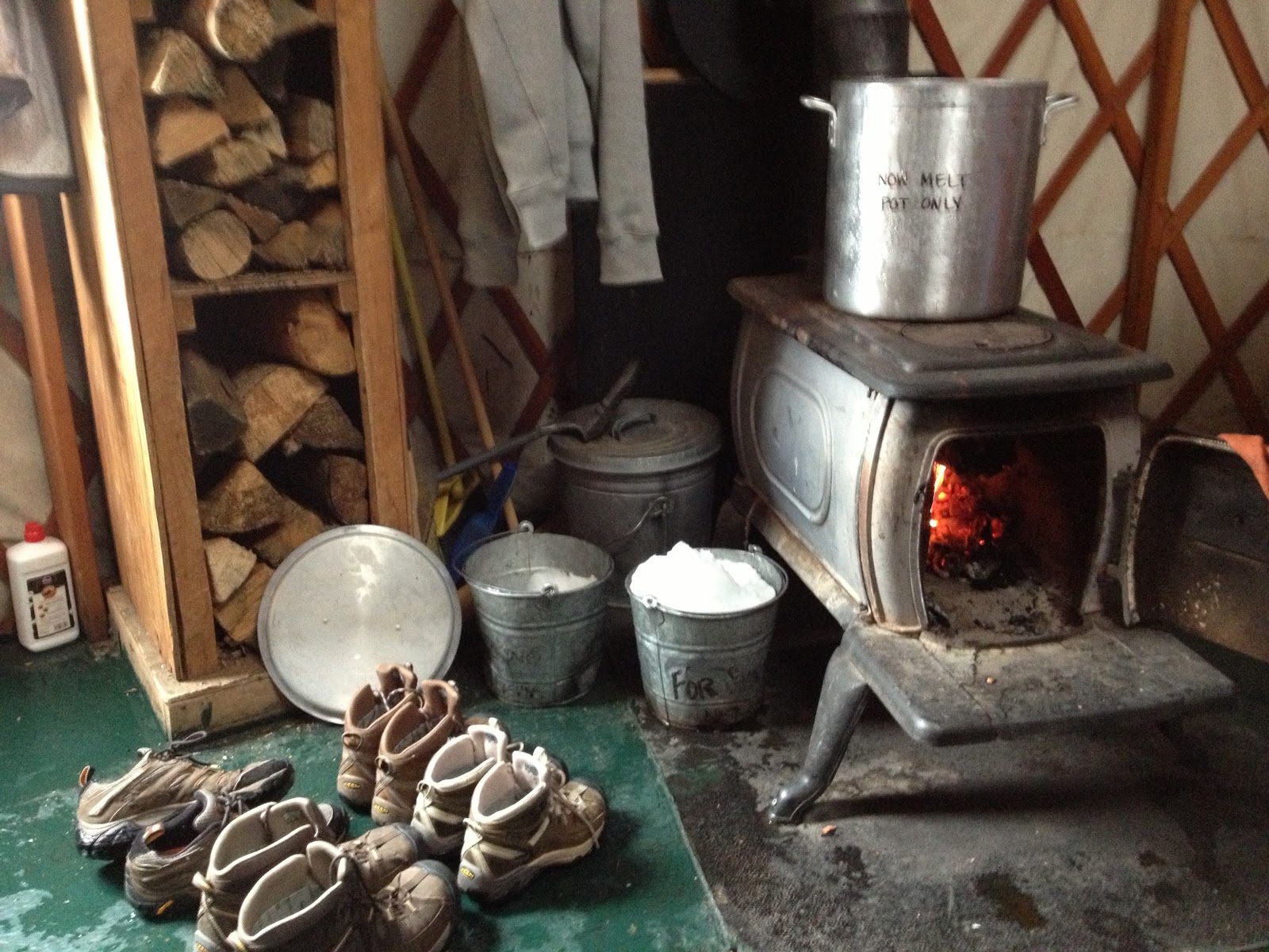
Ah, warmth.

Our kitchen. Rudimentary, but we still cooked up a storm (literally?)
After it started snowing we used snowmelt for our water needs.

Our winter wonderland.

The landscape nearby (from the car as we left).

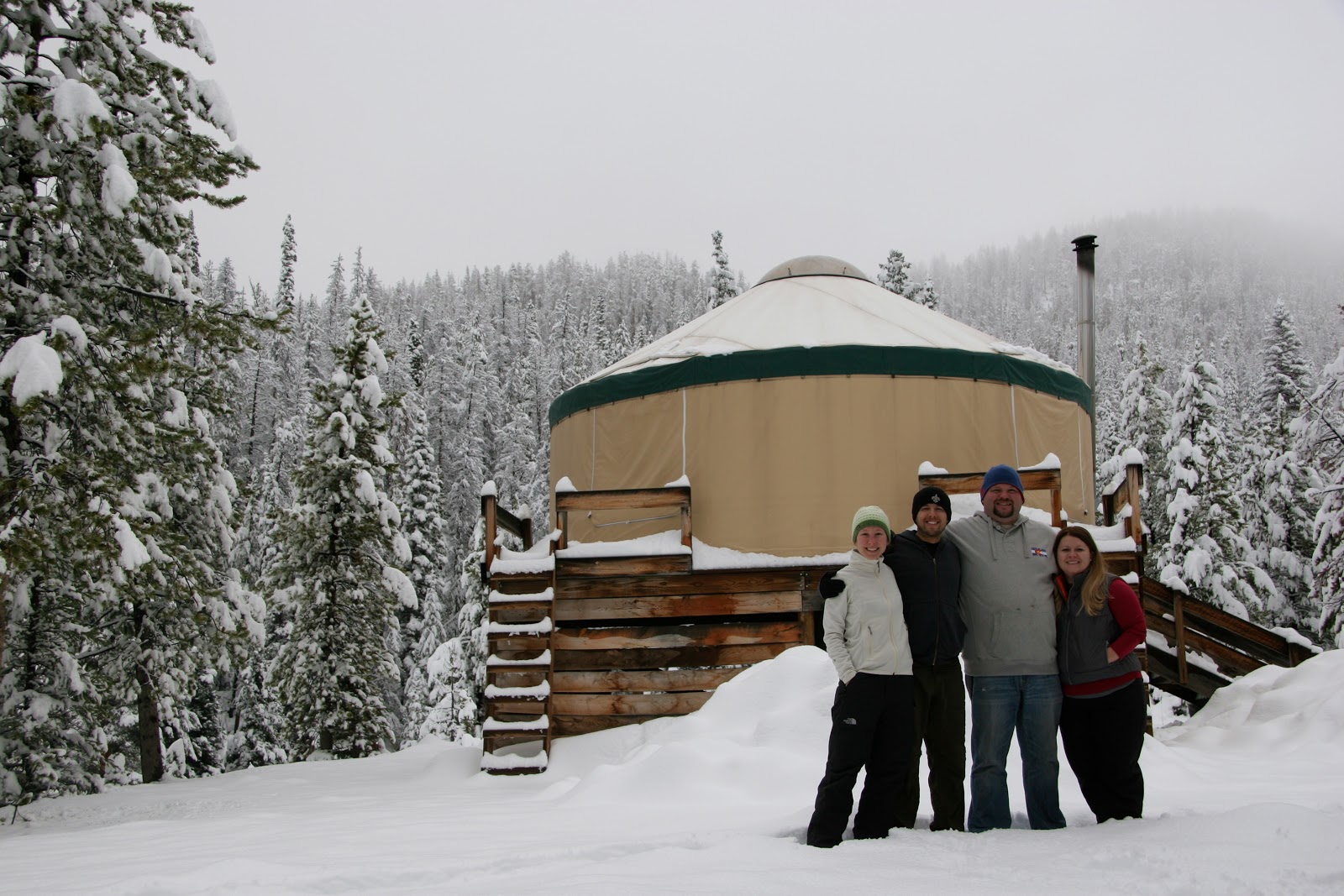
Photo op!

The group.

Late nights with Skipbo, good friends, and The Kraken (rum). ;)

Our New Home

It's official! J and I signed a lease in our new neighborhood of Arvada. We are right next to Olde Town so we have lots of restaurants and shops at our convenience. This time we hired movers (who showed up, loaded, unloaded and left in under two hours) and went shopping at Ikea. We are even in a condo now, rather than an apartment complex. Moving on up! 
Here are some photos from around the neighborhood. We have not taken pictures of everything so we have left out of our photo essay creamy cheesecakes, rich breakfasts, funky shops, and some awesome people (seriously, everyone is so nice!) but we hope to cover all of that in later posts. :)
We are near the water tower, which is fun because we can see it well from many parts of the city and we can always find home!
Yay, beautiful day!
J and I stopped in at a nearby tavern and grill and had some amazing food (crab cakes and veggie burgers). (Grandview Tavern and Grill)
There is also a place that serves nothing but Belgian fries and Belgian beers. They have 22 different sauces in which to dip said fries. It's pretty amazing. (Manneken Frites)
A section of our new Main Street.
New home pictures...this is a panorama of the bathroom.
Here is the bedroom/closet area. It's really the perfect size for us as far as storage is concerned. We also feel like adults with a bedframe that is not just made out of metal.
And here is the kitchen/dining/living/balcony. Handsome gentleman cooking in the kitchen not included.
Close up of the living area. We were very excited to be able to hang our photos up once again.
Our kitchen and dining have most of the items from our travels, and the maps work well there too.

J and I threw a small housewarming shindig the other night and we decorated the balcony with a fun strand or two of golden stars lights. Here they are at sunset.
Time to cook!
So wonderful...finally feels like home!
Thank you to everyone who made it over (and we miss those who weren't able to make it!)
Teaching Jett to pound it and blow it up.
Night has fallen!
We capped off the night with strudel from a German bakery nearby. We were festive with both pumpkin and cherry plum. (Rheinlander Bakery)
We could not have been more excited to see everyone again, nor could we have been more thankful to share our new place with everyone. <3 br="br">

Wednesday, September 12, 2012

Zion: Hidden Canyon

We're talking Indian Jones.
(I know you're thrilled, mom.)
So much of your experience on this trail is determined by how far you go.

Hidden Canyon Trail is off of the main trail up to Observation Point (Weeping Rock Trailhead). It has some quickly ascending switchbacks that then lead to stone-hewn stairs and narrow ledges complete with chains mounted in to the rock wall as a handhold lest you slip a little on said ledges. After this obstacle course there is an unmaintained trail that will take you as far as you wish to go.

We wished to go just a relatively short way down the canyon to where there is a small free-standing arch. That became our turn around point.

Hike details (completed in conjunction with the Observation Point hike):
Total Distance: 2 miles (+ 8 miles on the Observation Point hike)
Total Time: It took us about 2 hours.
Hiked on Monday, September 10, 2012.


Hold on to your butts!


These roots were handholds over this slickrock incline.
This blogpost is the perfect opportunity to mention our friend with whom we traveled to Zion. He has a broken arm. It's in a cast-sling thing. The only thing it isn't, is duck-taped. At one point, as usual, our friend traveled ahead of us on his ridiculously long legs. We asked a group of people if they had seen our one-armed friend.
They said, "Yeah, he's standing at the top of a really big, slippery, steep rock."
Of course he is.
We made it!


Zion: Observation Point

What a hike. It was the perfect hike for our last day in the park. We started at Weeping Rock Trailhead and completed both Observation Point Trail and as far as we wished to go on the Hidden Canyon Trail. This post will be about Observation Point. 

The best way to describe it is to say that you gain 2100 feet in 4 miles. It is through the most beautiful areas and every time you round a switchback the view becomes better and better. Always fun was the brief part through the aptly-named Echo Canyon where you can, of course, play with your echo. You keep passing other trails - East Rim Trail, East Mesa Trail - wondering when you will find some sweet relief from the trail that just keeps going and going and going. When you do, though, it really is perfect. (Can I say that enough?) You can look straight down Zion Canyon, and even down onto Angel's Landing, another popular hike in the park. 


Hike details (completed in conjunction with the Hidden Canyon hike):
Total Distance: 8 miles (+ 2 miles on the Hidden Canyon hike)
Total Time: It took us about 5 hours.
Elevation Change: +2,148 net elevation gain.
Starting Elevation: 4360 ft. 
Ending Elevation: 6508 ft.
Hiked on Monday, September 10, 2012. 
 

J points out the mesa that includes Observation Point. The very south point of this mesa is the final stop on the trail.


Springdale, UT (Zion National Park)

J and I recently spent the 7th of September to the 11th of September in Springdale, UT. A friend of ours had rented a vacation home for the week and along with himself, J and I, and three other friends, we enjoyed the town and its gorgeous national park. These are just a handful of pictures taken around the vacation rental property...this was the lazy wine-soaked evening side of our water-drenched hiking days. We all cooked, cleaned, and hang out together when not on the trail. J and I even prepared our North African Fish Stew for the group. It's the third time we've made it now and it's always a hit.

For our hiking adventures in Zion you can follow these links:
The Narrows (Bottom Up)
Northgate Peaks (East)
Observation Point
Hidden Canyon

:)


Zion: Northgate Peaks (East)

The Northgate Peaks hike begins at the Wildecat Canyon Trailhead (you can also reach The Subway from this trailhead). We found it in one of the trail hiking books and it sounded rather fun. A shorter hike with awesome views into the valley - and it even ended on a lava rock outcropping. Very cool.

I googled it just to see if I would like the pictures and that's when I found the Protrails.com guide which explained how to go beyond the lava rocks, hack through to a social trail, and scurry up (quite quickly) to the top of the slickrock East Northgate Peak following nothing but cairns and stones laid out in arrows.

It was fantastic!

The first part of the hike to the lava trail is relatively easy. Starting at the Wildcat Canyon Trailhead you walk on the mesa passing the junction for the Hop Valley Trail. Shortly after that you will come to the Northgate Peaks Trail. It's a right turn on to that trail and you will now be heading south towards the gulch and canyon. From there the trail will take you all the way to the lava rock formation. Right before reaching it you will see gorgeous views of East and West Northgate Peaks and the Guardian Angel.

This is where we continued on, past the guide book and into the land of ProTrails. I did a little research and found that West Northgate Peak is considered a Class 3 scramble (it looked it!) and East Northgate Peak is a Class 2 Scramble. Or as I like to describe it: it's about 250 feet ascending relatively quickly on slickrock. :D

From the lava formation look to the left and find the social trail winding down towards the base of the slick rock. Once there, follow the cairns and stone arrows to the top. Just be careful; you will be rewarded!

 Hike details:
Total Distance: 5.1 miles
Total Time: It took us about 3.5 hours or so. Lollygagging.
Elevation Change: +528 ft round trip, 174 ft net elevation gain.
Starting Elevation: 6,985 ft. 
Ending Elevation: 7159 ft.
Hiked on Sunday, September 9, 2012.